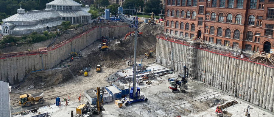
Monitoring of facility & construction
Monitoring the movements of a construction or a large facility project can be challenging in distinguishing between absolute and relative movements. This is primarily due to a poorly maintained network of height benchmarks with error-prone elevations due to settlements and physical relocations.
Buildings in Motion
Most benchmarks are located on buildings, so if the building moves up or down, the benchmark will move accordingly, resulting in inaccurate height measurements. The lack of maintenance of the height benchmark network has led to large areas without points, making it expensive to access accurate height data related to the official elevation system DVR90.
Impact on the Surroundings
The establishment and ongoing maintenance and quality assurance of benchmarks, which form the baseline or reference frame on a construction site or around a larger engineering project, are crucial for a smooth process for the contractor and surveyor.
A larger construction or facility project will usually affect the immediate surroundings, e.g., due to groundwater lowering and heavy traffic, which can affect the coordinates and especially the height of the benchmarks.
Precise Data
Accurate height data are often crucial in projects within urban development, climate, and infrastructure. History shows that the majority of the industry's compensation and insurance cases relate to errors in elevation.
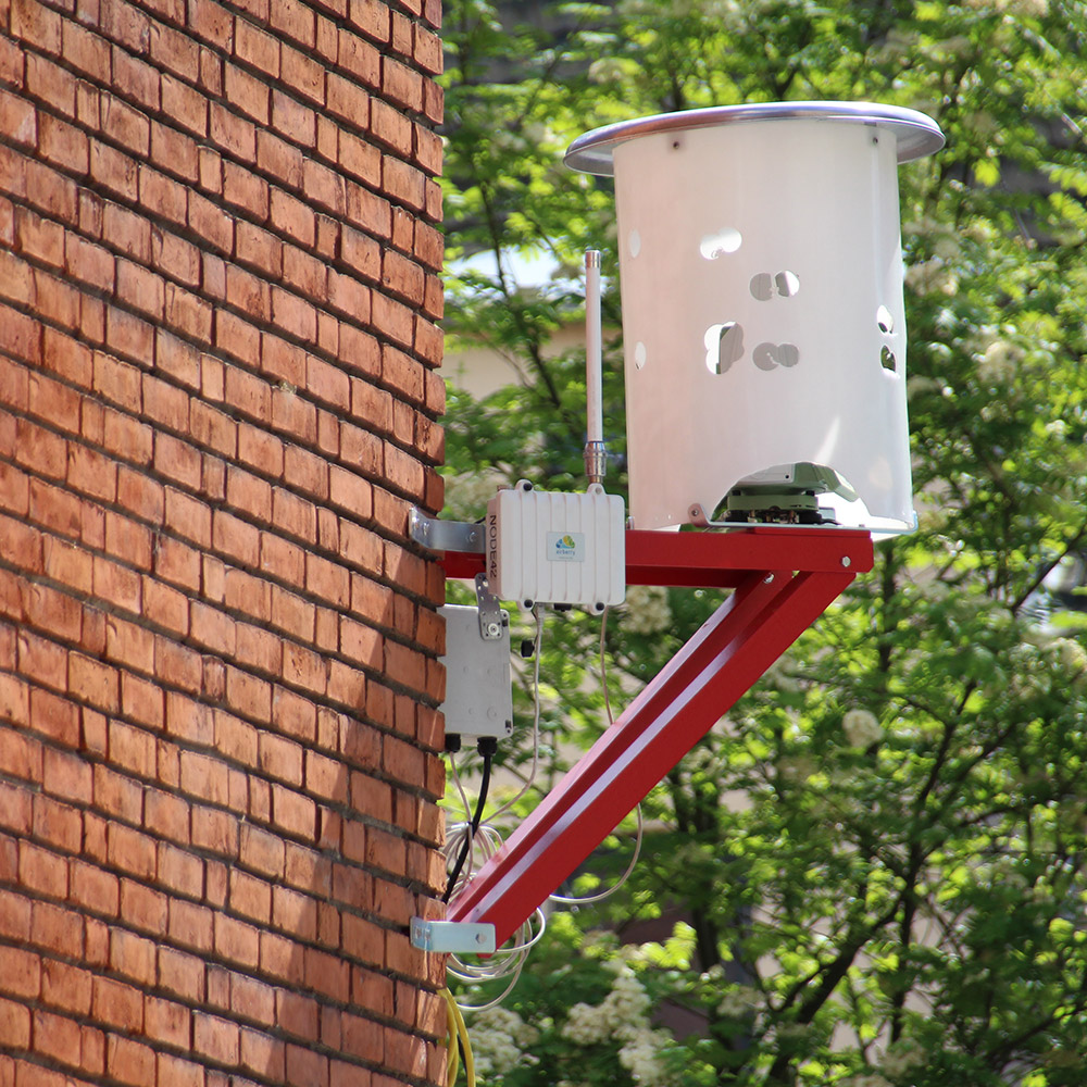
Therefore, the quality-assured "baseline" coordinates must be checked during the project period, and here the use of satellite data in combination with radar reflectors can act as a "hawk eye" and warn of the need for necessary control measurements.
By ensuring accurate height data and benchmarks:

The contractor gains confidence throughout the process.

You avoid unnecessary expenses and delays in the project due to errors in coordinates and elevations.

Economically advantageous for condition-based maintenance of the reference frame (benchmark network).